The Waterfalls Trail at Cloudland Canyon State Park explores the bottom of the canyon, highlighting the park’s two stunning waterfalls. Autumn is a wonderful time to take this hike because of the vibrant colors, and winter is the perfect time to see the falls with a strong, constant flow.
Cloudland Canyon State ParkCloudland Canyon is formed by the flow of Sitton’s Gulch Creek, which drops over 60 feet of rock outcrops to form these waterfalls. The 3,488 acre state park contains 30 miles of hiking trails, 30 miles of biking trails 16 miles of horseback riding trails.
Hiking the Waterfalls TrailThe trail begins at the Main Trailhead at the East Rim parking lot. The Waterfalls Trail branches off from the West Rim Loop Trail at a quarter mile, heading to the right and skirting the canyon walls. The trail is composed of dirt paths, wooden boardwalks, metal stairs, and at times muddy paths thanks to all the water running off the canyon.
Hemlock Falls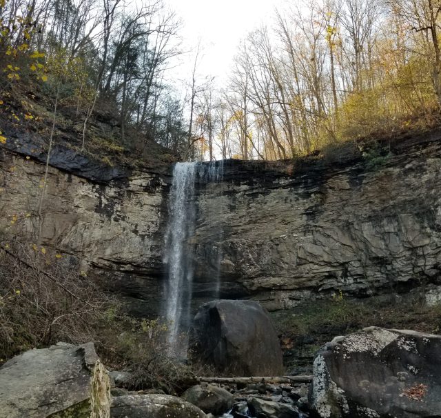
At the intersection, we started to the right, following the steeper half mile of stairs, about 600, down to Hemlock Falls. A wooden viewing platform looks out at the 90 waterfall. There’s a small path to the side of the platform that makes its way down to the creek, though park signs warn against climbing on the huge boulders at the fall’s base.
The hike back up the 600 stairs wasn’t as bad as I’d expected, maybe because of the autumn air keeping us cool. (It certainly wasn’t as rough as the stairs at Tallulah Gorge.)
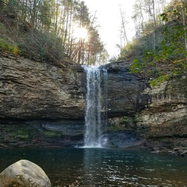
Cherokee Falls
Compared to that, the half-mile hike down to Cherokee Falls was a breeze. Here, you climb between rocks until you’re at the edge of the pool the 60-foot tall waterfall pours into. This waterfall offered a much more picturesque view.
These waterfalls are winter waterfalls, meaning that their flow is strongest in the winter when water doesn’t evaporate as quickly and throughout the year after a heavy rain.
We hiked back up, completing the trail at 2 miles at the Main Trailhead, and we realized that the hike had taken us hardly any time at all. So we decided to branch off at the West Rim Loop Trail and walk for however long we felt.
Bonus Hike: West Rim Loop Trail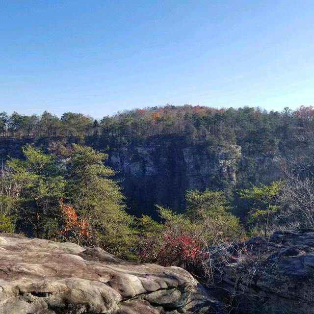
The West Rim Loop Trail branches off to the left from the Waterfalls Trail and heads down a flight of metal stairs, but after that, it’s all dirt path. The trail descends into the canyon and crosses a wooden bridge spanning Sitton’s Gulch Creek before climbing back up the west edge of the canyon through a series of switchbacks.
At just over half a mile, the trail passes by a small cave and then the park’s yurts. The trail soon opens up on the right side with rock outcrops and views of the canyon. The trail heads back into the forest and comes to the loop portion at just over a mile. This is where we turned around as the loop continued for 3 miles before circling back around. We retraced our steps, completing the hike at about 2.5 miles back at the parking lot.
Cheers!
Paige
What’s your favorite Georgia hike? Let me know in the comments!
Advertisements Share this:- More