This past weekend, I made a point to opt out of all the consumerist trends and commune with nature. Changing up my Sunday brunch routine, I headed up north to Sam Houston National Forest to prove a point that wilderness activities are easily accessible to Houstonians, and I’m capable of doing the nature thing.

Sam Houston National Forest is remarkably easy to get to…if you know where you’re going. DO NOT enter “Sam Houston National Forest” into Google Maps and expect it to get you there. It will take you to smack dab in the middle of the forest, down country lanes, and unpaved roads. It will NOT take you to the Forest Ranger Station with the maps and the trails. So how do you get there? Take I-45N up to exit 102 (about 50 miles north of Houston). Then follow the brown signs for Sam Houston National Forest Ranger Station. It’s a few miles to the west of I-45 on FM 1375. If you head east through New Waverly, you’re blindly following Google Maps and won’t get where you need to be. Although, you may see some cool Texas longhorns. Here’s the Forest Map.

Our main goal of heading up to Sam Houston National Forest was to go hiking! And once you find the Ranger Station, you’ll realize there’s no shortage of hiking trails across the park. We grabbed maps for Cagle and Stubblefield Lake and continued down the road until we came to those campgrounds. There’s all sorts of trails scattered around the 163,000 acres. The park is filled with sites where you can park for the day, picnic, camp, access the water, etc. The trails are marked by different symbols for foot, bikes, horses etc.
CagleWe started off our day at the Cagle camp site. Entrance fee is $5 for the day. Cagle has two hiking trails. One is pretty short and took about 20 minutes and traces the edge of Lake Conroe and the other was closer to 40 minutes and went through more wooded area with thick Spanish moss and palms. Making our way back to where we left the car, we then picnicked in the sun and laid out on the lake dock. A few people with boats passed us by and used the loading ramp to go in and out of the water. It would be a lovely escape in the springtime before it gets too hot!


Pro tip: Bring beers and #itsnothou koozies
Stubblefield LakeAfter seeing most of Cagle, we hopped back in the car and went a few miles further down the lake to Stubblefield Lake. At this site, we were able to park on the side of the road (no entrance fee). Plenty of people had done the same and were fishing in Stubblefield Lake. We made our way to the Lone Star Hiking Trail., which is close to 130 miles long and stretches all through the park. I felt Cagle site was pretty small, so it was exciting to make it through into some serious wilderness that extended for what felt like forever. All of the trails that we hiked on were fairly well marked and maintained. Along the trails, the trees were tagged with silver pieces of metal to indicate if we were to go straight or turn a certain direction. The Lone Star Hiking Trail was also marked with mile markers. Some trees had fallen down in some areas, so we had some adventures clambering over them Indian Jones style.


Now that I know where I’m going, I’m excited to go back to Sam Houston National Forest. Assuming you don’t get lost from Houston, it shouldn’t take too long to get there. And now that I know where to access the Lone Star Hiking trail, I hope to be back and explore more of it (I prefer that over the short loops). Also, after studying the Forest Map in more detail and becoming familiar with more of the camp names, I want to see some of the other sites and trails and maybe even dabble in camping! Fall and Winter are perfect times go exploring because its not too hot and there’s not a lot of bugs. The bathrooms at the sites are fairly well-maintained. So for a city-slicker like me, a one or two day camping trip would be manageable.
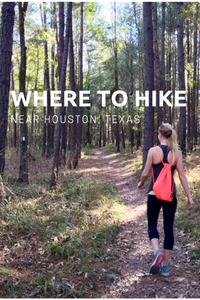
Where do you like to go hiking around Houston?Pin for later…