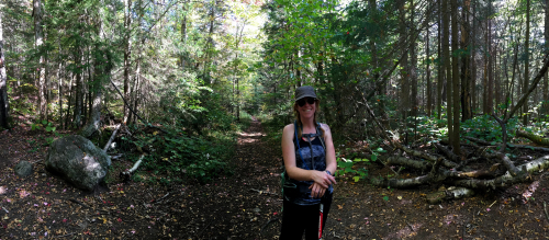
After finally becoming an Adirondack 46er in 2016, I was looking for other peaks to hike in the northern half of the Adirondack Park. But due to my health at that point in time, I was more interested in the smaller peaks that still offered somewhat of a challenge and a view. There are several other “challenges” out there, including the Fire Tower Challenge, the Cranberry Lake 50, and the 29er Challenge. Since I’m a big fan of challenges, I opted to focus on the Saranac Lake 6 to become a “6er”. After my first peak, I was in love.
The “Saranac 6” are 6 mountains located in the vicinity of Saranac Lake, NY, in the northern part of the Adirondack Park. They are often overshadowed by the nearby High Peaks (mountains over 4000′) but they are highly enjoyable hikes that deserve their own recognition.
As the Saranac Lake website states:
As an enticing — and more modest — alternative [to the 46], Saranac Lake put together a great lineup of six fantastic area mountains ranging from 2 to 10 miles in length. Those who conquer all six earn the esteemed title of 6er. Hiking buffs, don’t be fooled here. You can still challenge yourselves with the ultimate challenge of climbing all six in a 24-hour period to earn the title of Ultra 6er.
Even though these hikes are considerably shorter in distance than the High Peaks, the trails and climbing conditions are very similar. The trails are just as rugged and wild, sometimes even more so because they are not as well-travelled as some of the more popular high peaks. They have stunning views and McKenzie Mountain’s distance, altitude and level of difficulty is comparable to some of the other hikes I’ve done in the High Peaks area.
Each of the peaks in the Saranac 6 have their own vibe. St. Regis has a firetower, Scarface has stories, Ampersand has the stone staircase, Baker is short and in the village, while McKenzie and Haystack, sharing the same range, are very High Peaks-ish.
The beauty of these mountains is that because of their shorter length, there is no pressure to be fast. I’m not exactly talented when it comes to physical endeavours so I tend to be on the slow side of average when hiking. When faced with a long round trip up some of the higher peaks, there isn’t a lot of time to stop and enjoy the beauty around you. On those long days – my longest was 14 hours – I always felt a certain amount of pressure to keep moving so that I wouldn’t have to hike out in the dark. But the Saranac 6 allow you to take your time, stop and get that perfect photo, examine that interesting fungi on a fallen tree, chat with other hikers, catch your breath and generally just enjoy the hike a whole lot more.
The Saranac Lake 6 are for everyone. That is another aspect that sets it apart from the higher, longer and more difficult peaks in the area. I’ve met so many friendly people while hiking – families, young couples, photographers, avid hikers, groups of camp kids, new hikers, older, more-seasoned hikers. There is no need to compare these to the high peaks. While they offer similar terrain, these are truly wonderful peaks on their own and should be given their due.
If you are interested in hiking the 46 but aren’t sure what to expect, want to test out some new gear or want to start winter hiking, I highly recommend hiking the Saranac Lake 6 first. The trails are rugged and long enough to get a good feel for your clothing, boots, snowshoes or whatever other gear you want to test. But not so long that you can’t turn around and get back to the car in a short-ish amount of time if you need to.
That being said, these peaks are too enjoyable to be considered “starters”. These trails and the quest to become a “6er” are the perfect excuse to get outside and enjoy the company of friends, family or even just yourself for half a day.
St. RegisSt. Regis is a beautiful hike. Here is a more detailed report of what to expect along the trail. (There’s no point in my rewriting it because this site does it really well already.) It starts out Adirondack flat (which means not really flat but with no major gain or loss of elevation over time) for about an hour. After that, it starts to climb moderately for about another hour, including an interesting staircase. The summit is quite large and is open rock. There is a fire tower as well and as of summer 2016, it is now open to climb. Of course, if you are in shape or are an experienced hiker, you may cover the whole 3.3 miles (5.3 km) to the summit in less time. On the other hand, if you haven’t been physically active for a while, you’re a new hiker, recovering from an injury or your body just doesn’t work like it used to, it may take you longer. I was recovering from a bad cold so it took us two hours to get to the summit. Don’t underestimate it though, it will get your heart rate up. But it’s not for long.
In the winter, your ascent might be longer and harder. It all depends on your comfort level with your equipment, weather and your overall fitness level. The ascent took about 2.5 hours and with butt-sliding down, it took us only only 1.5 hours to get back to the car. In winter as in summer, it’s important to remember that it won’t always be faster going down than going up. Ice is a major concern, especially if you don’t have the right equipment. I’m not going to write a tutorial on winter hiking but do some research on appropriate equipment and conditions before heading out.
Here are some summer scenes:
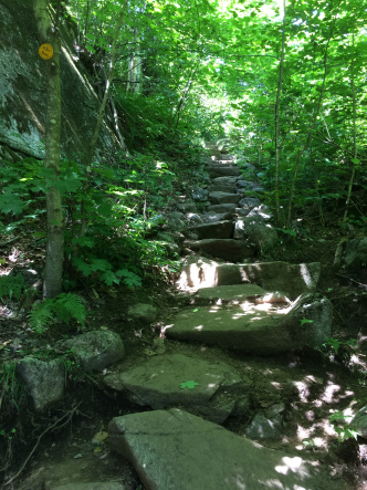 The staircase.
 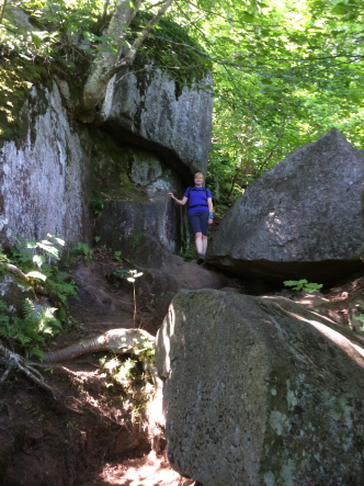 About a quarter-mile to the top.
 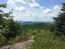 The first view.
 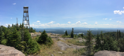 The fire tower on the summit.
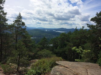
 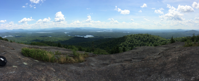 The view from the summit of St. Regis.
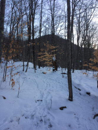
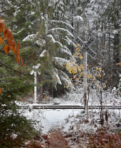
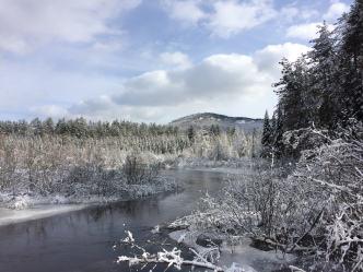
Here are some winter ones:
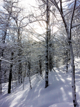 It’s impossible to put into words how beautiful the trees were.
 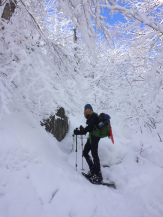 We are getting closer to the summit and the scenery just keeps getting better.
 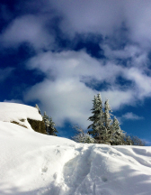 The summit is just ahead!
 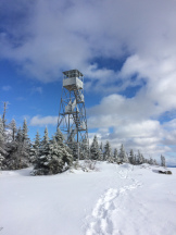 The Fire Tower, now open.
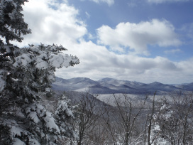
 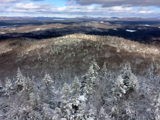 One of the stunning views from the fire tower.
 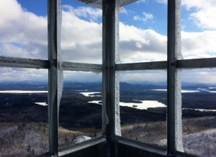 The view to the south-east, in the direction of the high peaks.
 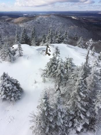 I just couldn’t stop taking pictures.
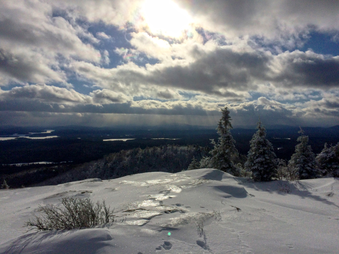
Awesome things about St. Regis: the relatively flat walk in allows for great conversation; it’s also on the Fire Tower Challenge; the spectacular 360° view; the large open-ish summit; the great butt-sliding in winter.
Baker MountainBaker Mountain is the shortest distance to cover (0.9 miles or 1.5 km to the summit) and takes the least amount of time. But it’s a fairly consistent, moderate grade the whole way up (with a couple of flat bits and steep parts thrown in for good measure). When I climbed it in the summer, it took me 35 minutes to get to the summit and less than half an hour to descend. There were teenagers there who made it to the top in 25 minutes and as I was heading down, I met an older couple who were going slower than I was. Again, this little peak is great for families, for a beginner winter hike or for some morning cardio. At the first lookout to the west, there is a view of Saranac Lake village and at the summit, there is a lookout to the south. Both lookouts are obscured by trees but the views are still quite lovely. The actual summit is in the trees.
In winter, it took me 40 minutes to get to the summit because of ice. There wasn’t enough snow for sliding down (and sliding on ice over rocks and through the trees just seemed a little too daring for someone my age) but it still took less than half an hour to descend.
Summer scenes:
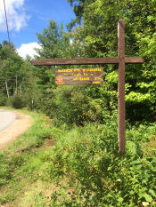 The trailhead sign.
 The view from the lookout, looking over the village.
 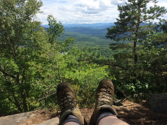 This is the view from the summit lookout.
Winter scenes:
 Baker Mountain is ahead of us.
 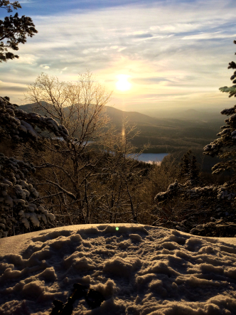 Sunrise on Baker Mountain at 8 am.
 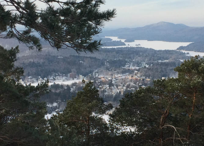 The village of Saranac Lake.
Awesome things about Baker: it’s nice and short – you can do it late in the afternoon or early in the morning and then go for breakfast after; the scenic village looks like a tiny, toy town from this altitude; a treed summit and shaded lookout on a hot day; easily manageable with children.
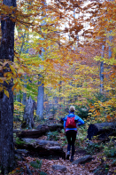
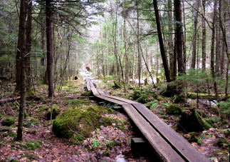
Haystack Mountain:Haystack Mountain is a classic hike. It has the perfect combination of Adirondack flat (gentle ups and downs), beautiful photo ops, as well as enchanting trails through the woods, and then, just after the dam, it starts to climb. The final stretch is fun scrambling on some steep rock accompanied by tree-grabbing. The view at the top is open and spectacular; it’s a large summit that can easily accommodate a larger number of people without feeling crowded, like St. Regis. This peak really gives a person a good idea of what it might be like to hike a High Peak. It’s 3.3 miles to the summit and you pass through every terrain (except for water) that you might find on other hikes in the Adirondack Park. In the summer, it took me about two hours to get to the summit. (Disclaimer: I hadn’t done any physical activity all summer except sit by the lake or campfire, drink wine and sing off-key.) Obviously, it took less time coming down but be careful as the soil is eroding and can be unstable. I took a small spill as my feet slid out from under me on the descent.
In winter, it took about two and a half hours to reach the summit. There is no summit sign so when the trail stops, that’s the summit. We had some lunch, took some photos and then headed back down since the winds atop the summits in winter can be very chilly. Don’t forget, you will sweat on the way up and very quickly cool off at the open top so bring appropriate windproof gear.
Summer scenes:
 This trail is a lovely walk through the woods.
  Here is the junction for McKenzie to the right.
 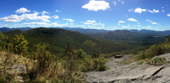 The view from the summit.
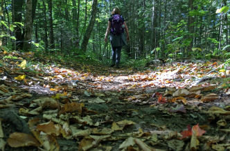
Winter scenes:
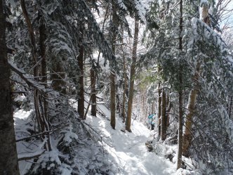
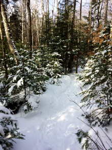 The trail meanders through a beautiful wood.
  The first 2.4 miles is an easy grade.
 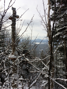 We are starting to get high enough for views.
 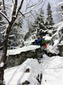 There is some steep climbing involved.
 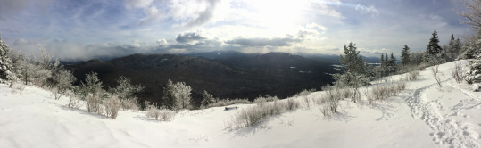 The view from the summit.
Awesome things about Haystack: the flat walk in gets you warmed up for the climb; there’s something magical about the forest that is really beautiful; it has a variety of different terrain – Adirondack flat, moderate and then steep – so it makes you feel like you’ve really earned the summit; the large open summit that can accommodate a decent number of people without feeling crowded; the view.
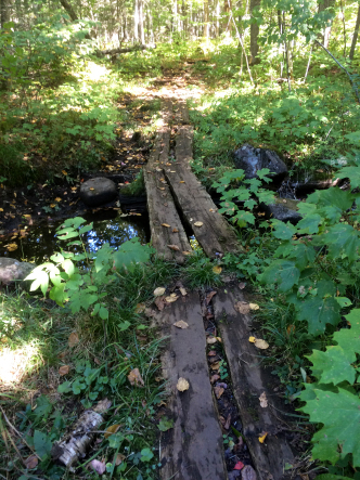
Scarface MountainScarface is more than just a hike in the woods. It’s a story in and of itself. It’s a lovely Adirondack walk past a variety of unexpected items and stories. First, there is a railroad to cross. Then there is a bench with a memorial plaque for an Australian soldier who died on Scarface in January 2014. There is also a wooden bridge that crosses beautiful Ray Brook and a rusted, antique bike sitting decoratively at the side of the trail. Truth be told, I couldn’t tell you anything about the conditions of the trail as both times I hiked it were in unpredictable conditions. But I seem to recall an easy grade in and then it climbs with only a few times in which the grade was steep. What sticks in my memory were things that had nothing to do with terrain.
The first time I hiked Scarface, it had a Walking Dead quality about it. Maybe it was the Terminus-like railroad in the middle of the woods or the loudspeaker voices we heard in the distance. Maybe it was the old-fashioned rusted bike that seemed as if it had been left there when the world ended or the fact that an Australian soldier hiked up this mountain on New Year’s Eve several years ago to die alone in the woods. Maybe it was the hunter dressed in Realtree camo holding a rifle, standing at the bottom of the trail on the first day of deer hunting season, that we didn’t notice until we were right in front of him, that added to the surreal quality of this hike. Or the fact that the rain turned to snow even though it was only October and we were not prepared for a heavy snowstorm. Or that, after the only real lookout (from which we didn’t see anything because we were basically in a cloud of snow), it was still another 15-20 minutes to the actual summit. (We knew the summit was after the lookout. We weren’t expecting 20 minutes through dark forest, with bad weather and looming darkness.) It all just compounded into a very strange introduction to Scarface. Oh, and the name: Scarface.
 Scarface started like this…
 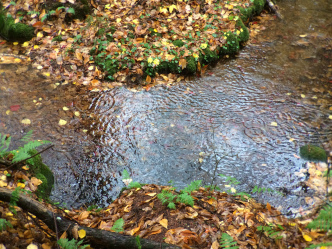 Then it started to rain.
The second time I climbed it was also a story. It was a February morning after a wicked thunderstorm (yes, a torrential downpour in February) that knocked the power out all over the Adirondack Park and turned into snow that covered everything and then froze. It was easily 15°C cooler the next day. We started out on an easy trail with all the markers easily noticeable. Then we crossed the little stream and…no more markers. We were the first on the trail so no trail was broken and the icy snow made the spindly branches bow to the ground everywhere, covering any trace of where a trail might have been. The tree trunks were covered in the wet, icy, sticky snow so any trail markers were deeply buried. We wandered around looking for a trail to no avail.
Then another group of hikers came and we followed them. But they’d also lost the trail so they were bushwhacking too. But they had a better idea of where the trail should be so eventually we all made it back to the real trail. It was a long and arduous journey through a lot of snow and added on an extra hour and a half because of it. At times, we were walking in snow up to our knees. And after everything we’d already done to get to the false summit, that last 20-minute walk through the woods to the real summit turned into over 30 minutes and seemed like it would NEVER. END. Then on our way down, we followed what we thought was the real trail only to discover that we were following the path of someone else who had lost the real trail and we were once again bushwacking. Finally, we found the trail again and by this time, we just wanted to get out of the woods. Scarface was a good reminder (both times) that even though these trails may be “short and easy”, one must always be prepared with compass and map, firestarters, layers of clothing and lots of water in case of unforeseen circumstances.
So having hiked Scarface twice, once in fall, once in winter but both with a significant amount of snow and unexpected circumstances, it still holds a place in my memory as a hike I would not quickly agree to do again. Except in summer. When it shouldn’t snow.
I’m not mentioning any of this to scare you away from Scarface. Just know…there is a very different feel to Scarface than all the others.
Here are some winter photos (because both hikes had snow):
 Five minutes into the trail.
 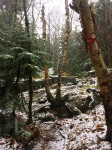 The trail was easily discernible at this point.
 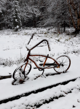 Yes, a bike. In the middle of the woods.
 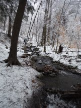 Somewhere around here, we lost the trail.
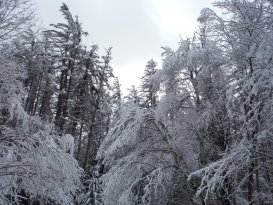
Awesome things about Scarface: Scarface is a lovely walk in the woods if the weather permits; there are many interesting scenes along the way that make Scarface a unique hike; it’s not a difficult hike (except when it starts to snow mid-October and you’re not prepared); everyone I know who’s hiked Scarface has a story to go with it; its name.
Ampersand MountainAmpersand is a popular hike with a big reward at the end. What makes Ampersand unique is its stone staircase and also its fairly consistent climb. The first half rolls from Adirondack flat to a moderate grade. And after the “Trail” sign, it starts to climb. But don’t expect too much rock scrambling. The stone staircase that was developed to prevent soil erosion makes the climbing up a serious cardio workout but, on the other hand, makes the descent a fast one with its remarkably even-spaced stone steps. There aren’t a lot of views on this hike but in my opinion, you don’t need a lot of views when hiking in the fall or winter because the forest itself is the view. The last 10-15 minutes is easy and finally, a wall of rock will face you. Go up. Carefully, especially in winter. And the 360° view will NOT disappoint. If you are lucky enough to summit on a day with only a little wind, continue on past the summit, where the wind is blocked slightly more. You’ll also find a plaque on one of the rocks, a memorial to the “Hermit of Ampersand“. It took us 3 hours to summit and 2 hours to descend (the staircase is really helpful in that regard!).
Please be aware that winds can be quite strong on the summits. The short video clip below shows a friend and I lying on the summit because we couldn’t stand; we seriously felt we might be blown over!
Here are some fall scenes:
 A beautiful time to hike.
 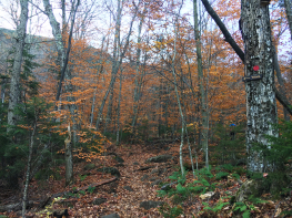 This “trail” sign is the only one on the trail and marks approximately halfway. Prepare to start climbing! (You can see Ampersand in the background.)
 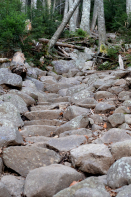 The rock staircase begins.
 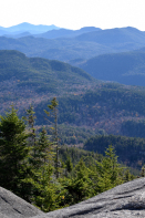 From the summit you can see Marcy and the ranges in the High Peaks.
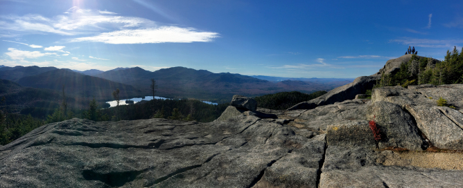
 This is an easy 10 minutes from the summit.
 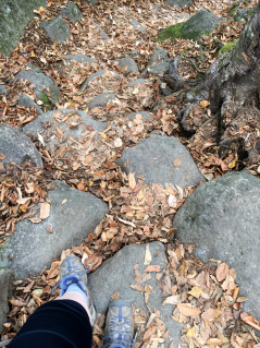 These conveniently placed rocks make climbing Ampersand a cardio workout but make descending much easier.
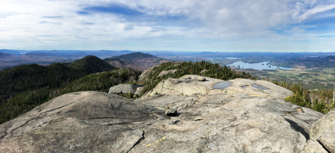
And some winter ones:
 This particular year, there was more snow in October than there was in February.
 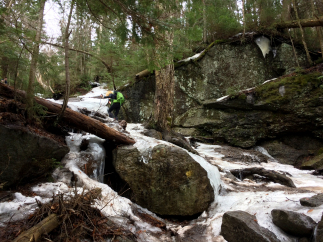 While we didn’t need snowshoes, we certainly needed microspikes to hike up the icy parts.
 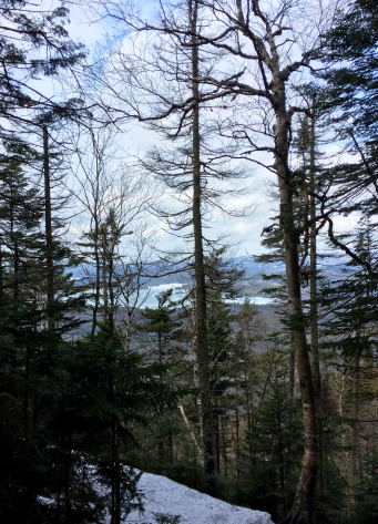 There aren’t many views on the way up Ampersand but you can catch a glimpse sometimes.
 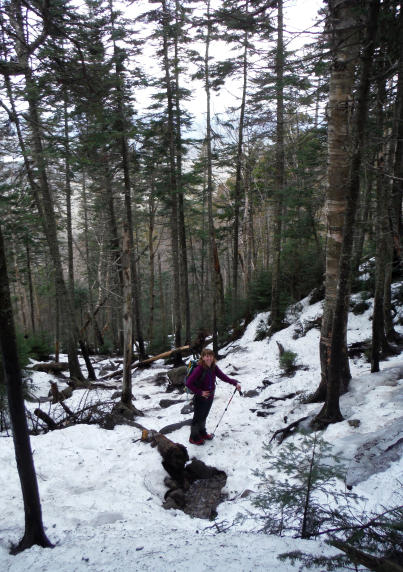 I don’t know what the temperature was but it was spring-like.
 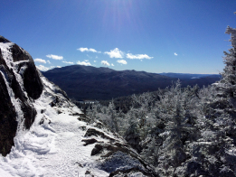 While in October, an early snowstorm made the summit look like the middle of winter.
 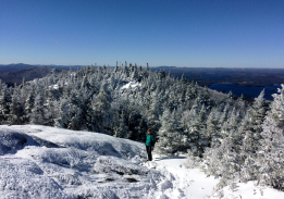 The snow made this fall hike feel more like winter.
 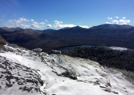 The summit view. It might not be as beautiful to some but for me, there is nothing more awe-inspiring than winter views.
Awesome things about Ampersand: It’s a very consistent hike; the summit is simply incredible; the footing is sure enough that you can hike with dogs and children, or bring a DSLR slung over one shoulder.
McKenzie MountainMcKenzie Mountain is the highest, longest and most difficult of the 6 and I was nervous about it. I had read that there were parts of it that were almost like climbing. I’d heard that it could take up to 8 hours to hike and that it was almost a High Peak in both height and difficulty. I was happily surprised.
We started from the Jackrabbit Trail on Whiteface Inn Road, just before Lake Placid, which cuts about 3.5 miles off each way. It’s a very gentle one-hour climb, half a mile past the Placid lean-to, to the junction with the trail that comes from Rt. 86 (the trail that heads to Haystack).
 Behind me is the Jackrabbit Trail. On the right side of the photo is the trail heading to the Haystack/McKenzie junction. The trail on the left heads up McKenzie.
 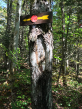 Look for this tree at the junction. It will be on your right and the signs are facing away from the direction you’ll come on the Jackrabbit Trail (not sure why).
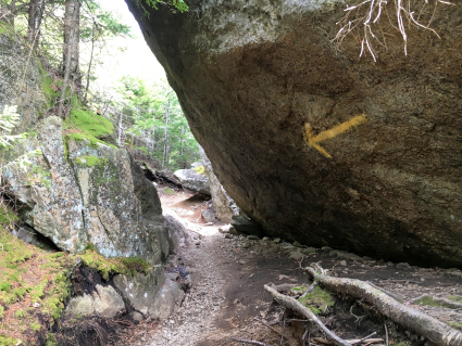
From there, it starts with an easy climb and soon turns into half a mile of steep climbing with some eroded sections that make footing an issue, especially on the descent. I can imagine hiking this in wet conditions would be far more difficult. In this section, we found many other herd paths going around large rocks. We lost the trail a few times following these trails. There aren’t a lot of red DEC trail markers but there are branches with orange flagging tape that were helpful. The trail was easier to see on the way down. While the other trails in the Saranac Lake 6 are quite obvious, this one needed a keen eye in spots. There are several “false summits” but they’re more like “bumps” than summits. There are several beautiful lookouts that are off the trail to keep your spirits up.
 This is the first lookout. After this, the steepness eases.
 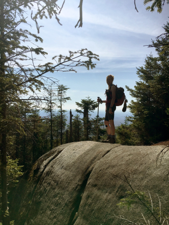 This is the second lookout, at a fork in the trail. Look for a little yellow trail marker pointing out the trail.
 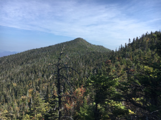 This is the next lookout, looking at the true summit. It looks much farther than it is. From here, it’s a 15-20 minute hike.
 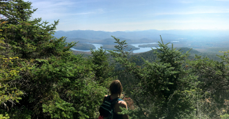 This lookout is to the right of the trail as you are heading towards the summit. It is mere seconds away from the treed summit.
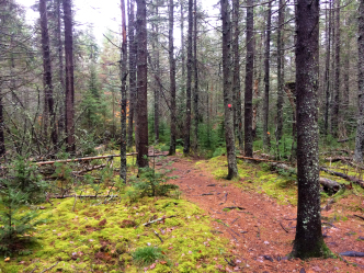
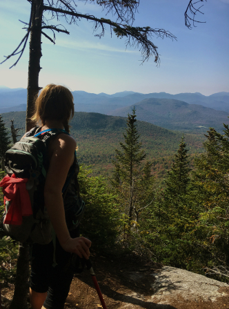
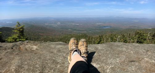
There are two lookouts almost across from each other, a mere minute before the treed summit. The one to the right is (when heading towards the summit) standing room only; the one to the left has a large enough space to accommodate around 6-8 people. The view is spectacular but it’s only one part of everything I loved about this hike. I loved the adventure of the steep rock scrambling at times. I loved the views and the fall colours were beautiful. I loved the enchanted-looking forest and kept hoping to find faeries in the lush, green moss. I loved the easy walk in (and of course, the easy walk out) and I also loved that it was a bit longer than the other five, making it an enjoyable full day outside.
Fall scenes:
 When you see this tree, veer right. I went left (yes, over the birch that was most likely laid across the path to deter people from going that way but I did anyway because I wasn’t paying attention and had to bushwhack back to the trail.) Sigh.
 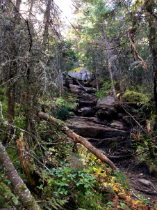 The trail had some great rocky parts.
 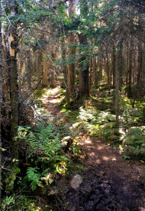 Much of the trail looked like this enchanted forest.
 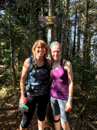 The sign is not facing the trail so we walked past it. And someone has put a thermometer there as well. In case you wanted to know the temperature. For some reason.
 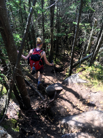 Some of the steep parts were rocky and others were loose dirt. Watch your step on the way down!
 The lookout to the north is larger, breezier and has a spectacular view.
Awesome things about McKenzie: It feels like a High Peak; it has some fun scrambling; there are many lookouts to whet your appetite as you climb; the panoramic views; it’s longer so if you are looking to spend a day in the woods, McKenzie fits the bill.
And of course, after you’ve finished hiking all 6, you get to ring the Saranac Lake 6er bell in Berkeley Square. Ring it 6 times, once for every peak you’ve climbed.
What are you waiting for? Happy hiking!
Share this: