I am just back from another long walk and don’t have much time to get a post written.
I have some ideas for some posts but they all need a little bit more work and are not quick writes.
So, here are some images from the latest segment of my Virtual Hike. This segment is from Halls Crossing, Utah to the Four Corners Monument.
 The images are all from Google Maps through Street View or Photo Sphere as are most of the images I use in my Virtual Hike posts.
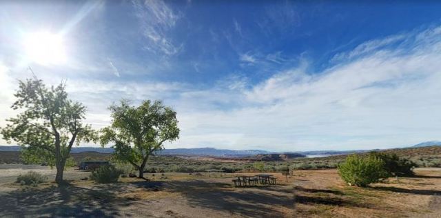
This is the view from the beginning of this segment at Halls Crossing. I had just crossed over the ferry from Bullfrog. See: Virtual Hike to Bullfrog
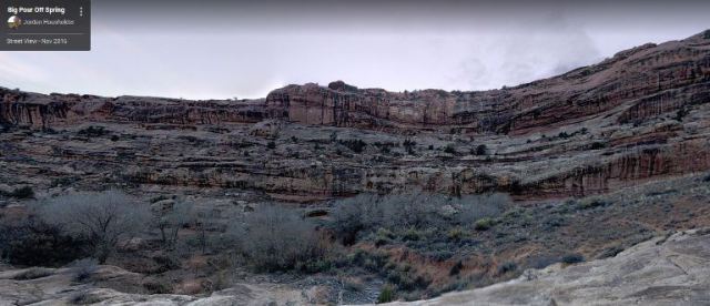 This image and the next one are just a bit off of the highway that I have been following, but there is no Street View on the highway so I have to rely on Photo Sphere images. This is a place called Big Pour Off Spring and is very beautiful. Go to Google Maps and find this as you can pan through a 360 view from the spot.
 The image above is one of the ones to the left of the Google Map person icon and the one below is just to the right.
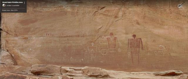 This image was taken by the same person as the previous one and is from the Grand Gulch Primitive Area. Here are some petroglyphs on the wall of one of the canyons. It would be really cool to see some of these in person instead of just virtually