8:48 PM Monday Evening
After pulling my hair out and enjoying a glass of red wine (while stewing over the latest High-Resolution-Rapid Refresh Models and the 18z GFS) below is my updated & final snow and sleet accumulation map for the blockbuster Nor’easter that will be impacting the Northeastern seaboard tonight through 2pm Tuesday:
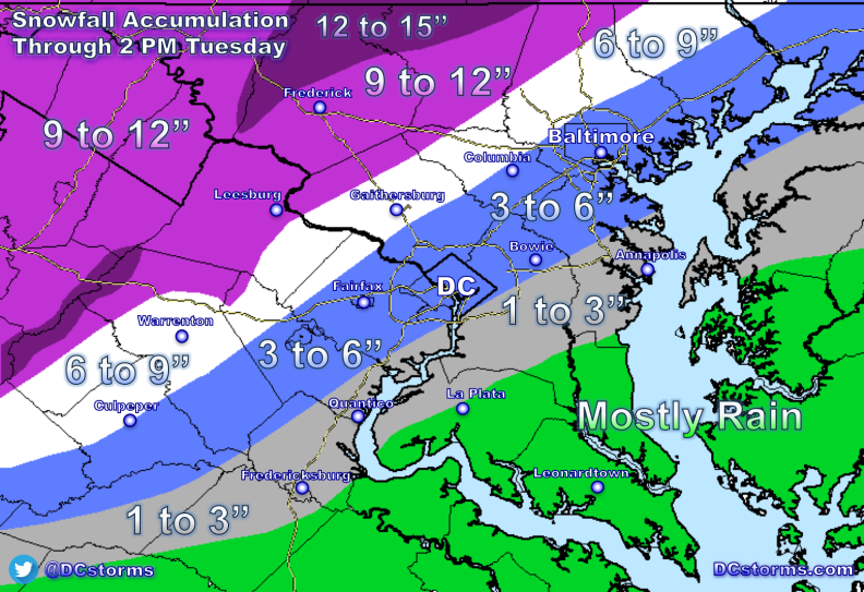
This is one of the trickiest forecasts I can remember for a “large storm” in the over 20 years I have lived in this Area. This storm has the potential to surprise between route 15 in Loudoun county and just west of the interstate 95 corridor where confidence is very low.
- The mid-levels of the atmosphere are dry and as precipitation begins to fall in earnest later this evening, temperatures should fall at or just below freezing along and west of interstate 95.
- Notice the orange colors on the latest HRRR model (indicative of heavy, accumulating sleet) moving westward into the 95 corridor. How far west this gets (or doesn’t) will have a huge impact on snowfall accumulations between route 15 in Loudoun county and interstate 95. Also look closely at the red 32 degree contour on the map… it wants to hold in strong along 95 overnight through 7am (by then the “damage” will have been done to area roadways.

Temperatures should remain at or below freezing through the morning rush hour (even in DC):

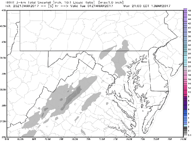
Latest HRRR shows snowfall accumulations ramping up (heavy snow after midnight):
- Secondary Roads will be impassable in our northern and western suburbs by morning!
According to the latest 12z European model from earlier today (the 00z is not out yet), it’s not entirely implausible that downtown Washington could get up to 5″ of snow and sleet out of this:

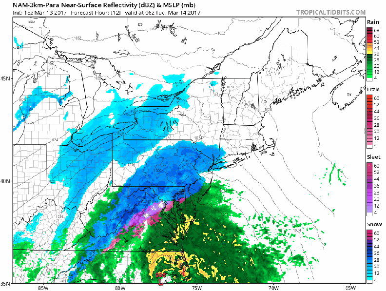
The models have been showing a track inland over the Outer Banks and then just offshore Ocean City… the Bay is warm and this is why there is a high chance of heavy, accumulating sleet pounding the 95 corridor between 3 and 7am before the colder air aloft swings back in causing the sleet to change back over to snow.
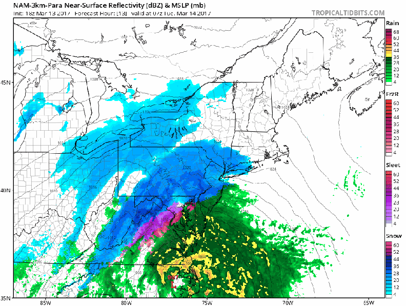
Here is the latest high-resolution North American Model showing the transition periods between Snow, Snow/Sleet/Rain and then Snow:
(7pm Monday through 1am Tuesday):
- This is the prime time period for Snow to accumulate across most of the Metropolitan Area outside of north-central Virginia and southern Maryland.

(2am through 7am Tuesday):
- At this point we could have everything from heavy snow to heavy sleet with temperatures at or below freezing (not pretty on area roadways)
- Thunder-snow or Thunder-sleet is possible during this time frame as this system “bombs” off our coastline (rapidly deepens).
- Snowfall rates of one to two inches per hour will be common in locations that remain all snow!
Height of the Storm from DC to Boston: (3am Tonight through midnight Wednesday)
Winds will be gusting over 40 mph at times tomorrow… the heavy, wet snow on trees and power-lines could cause scattered power-outages across our western zones.
I will provide updates on Twitter if anything (a shift in track) appears to be occurring. I expect widespread school closings (outside of lower southern Maryland).
Share this: