“The Valley”
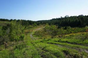
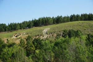
There is a place off the beaten path in Withlacoochee State Forest known to many locals as “Radar Hill” and when I first learned of that name I wanted to find out more about the history behind it. I have hiked around the area and this part of the forest reminds me of a scenic valley because of the rolling hills and karst formations. This section of the forest is located in Citrus County along the Brooksville Ridge. “The Brooksville Ridge is a linear, positive-relief topographic feature extending from northern Citrus County, through Hernando County, and into southern Pasco County.” These areas of the florida have a lot of hilly and karst terrain.

Similar Radar Base in North Carolina
During the Cold War years starting around 1958 to 1970, there was a radar facility located atop the one of the hills in the area. It was known as the “Inverness Gap-Filler Annex,” the radar facility was operated by the U.S. Air Force as part of a nationwide network of air-defense early-warning surveillance radars. The intension of the base was to watch the skies for attacking Soviet bombers and thanks in part to this radar network all across the country no attack ever came. Due to the curvature of the earth, as well as hills, river valleys, and other obstacles, gaps existed at lower elevations where the long-range radars could not detect targets so these radar sites were a vital defense network.
Radar Hill Area
The reason this site was chose is because “Radar Hill” itself was one of the highest points in the Withlacoochee State Forest, and offered a clear line of sight for many miles. Placing the radar on top of the limestone hills plugged the holes.
I am not sure of the exact timeframe but sometime after the site was used by the military it then became the location of a limestone mining operation. The land was mined and the hills were excavated. The radar and any evidence from the base were removed or destroyed during that time. The mining operations ceased eventually and the area became part of Withlacoochee State Forest. New trees were planted and slowly nature has been reclaiming the land here. The former mine now appears as open valleys through the forest which makes for a scenic experience. I myself have nicknamed the area “The Valley”. Check the link below on How Radar Hill got it’s name for more photos and information.
The site is public land now although there are no marked hiking trails here so it can be accessed from some of the old roads and paths around the area. Be cautious if you explore around and some areas within this section have been fenced off with no trespassing signs.
My Video
“The Valley” in Withlacoochee State Forest
Resources
How Radar Hill Got It’s Name
Withlacoochee State Forest
Brooksville Ridge
 Aerial View 1960’s-1970’s
 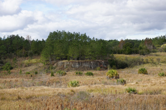 View of Area
 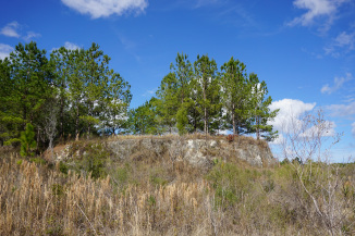 View of Area
  Modern Aerial View
Share this: