At the northeast tip of the Bronx is an ear-shaped peninsula framed in the back by The Lagoon, a body of water separating the peninsula from the park’s larger section.
It is a quiet and shallow waterway on the city’s periphery, as natural as it gets in a densely urbanized borough. Its shape is manmade as it once separated islands from the mainland prior to becoming part of the largest land reclamation project in the Bronx.
Where it is

For a change, I’ll rely not on a historical map or an aerial survey, but a NOAAA nautical chart, one which shows the water’s depth at the western tip of the Long Island Sound. The Lagoon appears to the north of Hunter Island and Rodman’s Neck.
The Lagoon’s depth ranges from a foot to 12 feet, shielded from the sound, making it an ideal incubator for marine life. The peninsula containing Rodman’s Neck and Hunter Island is best known for Orchard Beach, the crescent-shaped expanse of sand that is the Bronx’s only public beach. To the east of Hunter Island are Glen Island and Davids Island, which are respectively within the Town of Pelham and City of New Rochelle, Westchester County.

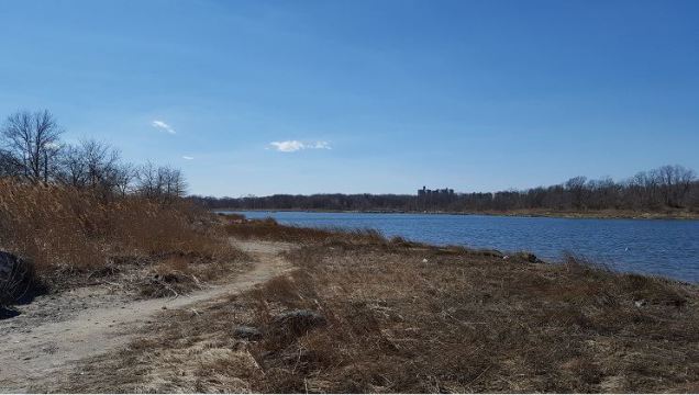
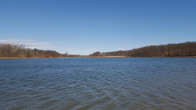
At the head of the lagoon looking north, one could imagine how the landscape appeared to the native Siwanoy and the earliest European explorers. Far on the horizon are the Avalon on the Sound and Trump Plaza towers of downtown New Rochelle. On the left is the park’s mainland which has the Pelham-Split Rock Golf Course and Bartow-Pell Mansion. On the right is the Orchard Beach section.
Observation Tower
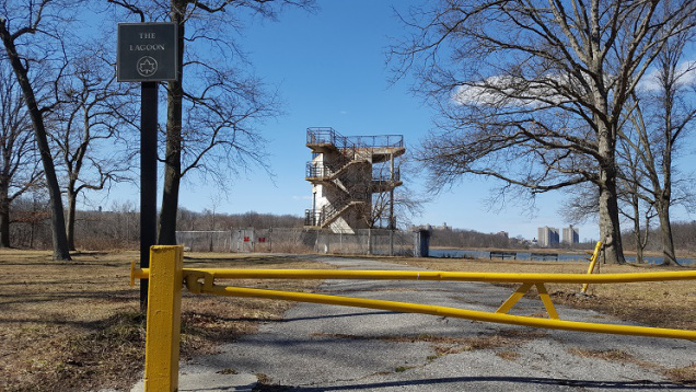
In the 19th century, points and capes in the city were fortified to prevent a foreign naval attack and during the world wars, Civil Defense volunteers stood watch for German submarines. In the early years of the Cold War, Hart Island and Breezy Point hosted Nike missile bases. With this history in mind, I am curious about the fenced-off concrete platform on the eastern side of The Lagoon. Was it designed for a military purpose or merely for bird watching?
Nearby, the Art Deco-style Pavilion that contains the park’s offices, concessions and bathhouse is combed with thick-walled concrete hallways that bring to mind fallout shelter tunnels. Had the Nazis or Soviets made their beachhead here, the sunbathers could quickly scurry into the Pavilion.
The Parks Department website uncovers the mystery:
The lagoon was widened and dredged when it was chosen as the site of the 1964 Olympic Rowing trials. In the process many small islands in the lagoon, such as Rodger’s Island, were eliminated. Parks built a viewing tower along the southeast edge of the lagoon for the trials, and the United States 1964 Olympic Rowing Team went on to win two gold medals, one silver medal, and one bronze medal in Tokyo, Japan.

Above is a Parks Department archival photo showing the rowing trials and the observation tower. The Lagoon has a long history as the site of rowing events. A 1966 map of Pelham Bay Park from the collection of Pelham Town Historian Blake Bell shows this waterway as the “Rowing Basin.”

Other curiosities on this map are the “area to be filled, 1965” which will become the Pelham Bay Landfill; and the swamp framed by the New England Thruway and Hutchinson River that will become Co-op City.
Orchard Beach
Where exactly was Pelham Bay, the namesake of the park? Some old maps suggest that it is Eastchester Bay, while I presumed that it was the crescent shoreline of Orchard Beach.

Looking north on Orchard Beach, the treetop on the left is the former Hunter Island while another hill in the distance is the former Twin Island. Former because in 1936 they were fused together with Rodman’s Neck and each other to increase parkland. Both have chapters in The Other Islands of New York City, a book that shares the same publisher as Hidden Waters of New York City.
The fine grains of sand at Orchard Beach are a rarity for Long Island Sound. That’s because Parks Commissioner Robert Moses had the sand dredged out from the ocean and deposited here by barge. Most beaches on the Long Island Sound have a coarse surface comprising of rocks that eroded into pebbles. Sunken Meadow State Park on Long Island is also a Robert Moses creation. It also has oceanic sand on its beach.
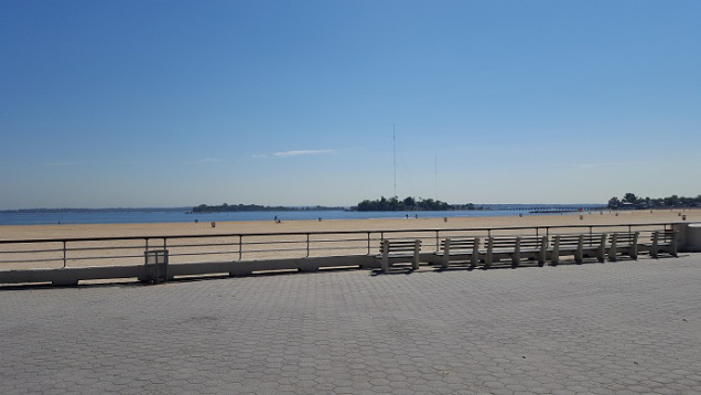
Looking southeast, the shoreline of Long Island is on the horizon, followed by the no-access Hart Island, and High Island with its radio antenna.
Formation of the Lagoon
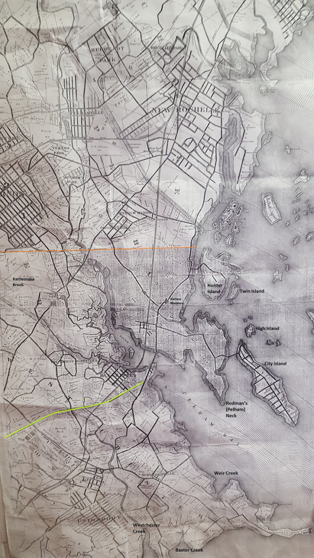
As often as I cite the 1865 Viele map for Manhattan and the 1891 Julius Bien atlas for the other boroughs, the 1889 Hyde Map shows us the eastern third of the Bronx when it was still belonged to the Towns of Pelham, Eastchester and Westchester. All of this will become part of New York City in 1895, but on the map above the “proposed annexation line” is marked, I colored it in orange, along with the proposed Pelham Parkway in light green.
The water between Hunter Island and Rodman’s Neck is where The Lagoon is located. At the time it was a shallow inlet that gave the Bartow-Pell Mansion an unobstructed view of the Long Island Sound. Some old maps and books name this inlet as Leroy’s Bay.

By 1938, the inlet around Hunter Island had been reduced to The Lagoon with the crescent shape of Orchard Beach taking shape. On the mainland side of The Lagoon, the Pelham-Split Rock Golf Course covers the land where the Battle of Pell’s Neck was fought in the American Revolution. Hunter is no longer an island and within 20 years, Twin Islands will also be fused to the reclaimed land.
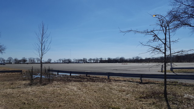
The largest parking lot in The Bronx covers 45 acres of land with nearly 8,000 cars that could park on it. This flat expanse was the open waterway in the 1889 Hyde map. Most visitors to Pelham Bay Park go to the beach side of the park, but when it comes to Hidden Waters, it is The Lagoon that piques my interest.
Looking north towards New Rochelle, I can think of the possibilities of future book ideas and tours as there are dozens of islands along Westchester County’s coast between the Bronx and the Connecticut border. Some of the islands are still privately owned to this day and others are run as parks by the county, and then there’s Davids Island, a former military base that is awaiting redevelopment while nature reclaims it.
Books about Orchard Beach
Here’s a Wednesday feature I haven’t done in a while, books that I’ve used as sources for my Hidden Waters research.
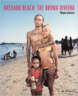 Lawrence, Wayne “Orchard Beach: The Bronx Riviera” 2013
 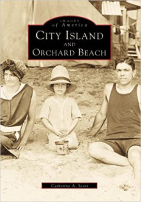 Scott, Catherina A. “City Island and Orchard Beach
Two great books on the Orchard Beach peninsula are a photo essay book and a historical guide. If you’re fascinated by the massive popularity of tattoos but too shy to ogle at the sunbathers, Wayne Lawrence’s “Orchard Beach: The Bronx Riviera” shows how the often-neglected beach is beloved by working-class Bronxites eager to escape the oppressive summer humidity without leaving their borough.
Catherine A. Scott’s book “City Island and Orchard Beach” provides the early history of this popular park and how it appeared before Robert Moses’ land reclamation project reduced an inlet of the Long Island Sound into The Lagoon.
I should certainly mention Sharon Seitz’s and Stuart Miller’s “Other Islands of New York City” as vital in understanding the history of Hunter Island and Twin Island.
Meet the Author
I will be lecturing on the history of The Lagoon and other nearby streams on Sunday, April 2 at 2pm, at the Bartow-Pell Mansion Museum. For more information, contact 718-885-1461. Signed books will be available for sale.
In the News:
BK Paper reports on the approval for the revamping of Shore Road Park in Bay Ridge, Brooklyn.
Bronx Times provides an update on the effort to daylight Tibbetts Brook.
Hudson Valley One reports on a new Hudson River waterfront park planned in Saugerties.
Advertisements Share this: