NOAA Teacher at Sea
Samantha Adams
Aboard NOAA Ship Hi’ialakai
July 25 – August 3, 2017
Mission: Woods Hole Oceanographic Institution (WHOI) Hawaii Ocean Time-series Station deployment (WHOTS-14)
Geographic Area of Cruise: Hawaii, Pacific Ocean
Date: Thursday, 10 August 2017
Weather Data from the “Bridge”:
Latitude & Longitude:21.3245#oN,157.9251oW. Air temperature: 86oF. Humidity: 48%.Wind speed: 14 knots. Wind direction: 45 degrees. Sky cover: Scattered.
Science and Technology Log:
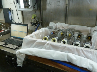
Downloading data from the MicroCats on the WHOTS-13 buoy’s mooring line. Back on land, the instruments will be given a more thorough cleaning, re-calibrated, and re-used next year on the WHOTS-15 buoy.

Packing gear into the shipping container returning to Woods Hole, Massachusetts, at the end of the WHOTS-14 buoy deployment.
The data has been downloaded. The instruments have been cleaned and removed from the buoy. The lines and winches and capstans have been removed from the Hi’ialakai‘s deck. It’s all been packed away into a a shipping container, headed back to the East Coast. Next summer, it will all be shipped to Hawaii again, to head out to Station ALOHA for another year at sea, as part of the WHOTS-15 buoy deployment.
As I sit in the gate area at the Honolulu International Airport, waiting for my flight back to New York City, I’m thinking about everything I learned in my time aboard the Hi’ialakai. I’m thinking about the best way to convey it all to my students — because I love using data in my classroom. One of my favorite things to do, when I am introducing a topic, is to give them a data set — either raw numbers, graphs, or other visualizations — and have them draw some preliminary conclusions. What is the data doing? Are there trends that you notice? Does anything stand out to you? Look weird? Because I teach Earth Science, there is a wealth of publicly available data, from the USGS, from NASA, from NOAA. For just about anything I choose to teach, from the atmospheres of exoplanets to mass extinction events, a quick Google search almost always yields useful, peer-reviewed, scientific data. However, until I had the opportunity to sail aboard the Hi’ialakai and observe the deployment of the WHOTS-14 buoy and the retrieval of the WHOTS-13 buoy, I never quite appreciated just how difficult obtaining all the data I use could be.
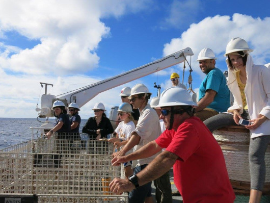
Members of the science team and crew of the Hi’ialakai. Photo courtesy of Kelsey Maloney, University of Hawaii.
Despite my best efforts, I think my students still believe that science is a solitary pursuit — something done by people in white coats in a lab somewhere. I hope that my experiences aboard the Hi’ialakai will help me paint a more realistic picture of what science is all about for my students. It’s a highly collaborative profession that needs people with all sorts of skills; not only science, but computer programming, mathematics, technology, logistics, resourcefulness and patience. I also hope be able to impress upon my students just how difficult doing good science can be. I know that I will certainly never look at the data sets I download with just a few clicks of my mouse the same way again.
Personal Log:
I would like to take this opportunity to say mahalo nui loa (thank you very much) to everyone aboard the Hi’ialakai for the WHOTS-14 cruise — for answering all my questions, even the ones I didn’t think to ask; for sharing data, seasickness medication, hardhats, and the occasional power tool; for the fabulous meals (and the best chocolate chip cookies ever!); for the impromptu education about monk seals and the philosophical discussion on fidget spinners.
It’s been a truly unforgettable experience, and I can’t wait to dig into the hard-won data from the WHOTS buoys and share it all with my students.
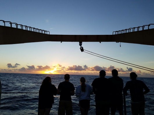
Enjoying yet another gorgeous Hawaiian sunset at sea. Photo courtesy of Kelsey Maloney, University of Hawaii.
Did You Know?
Dry land can feel like it’s moving, too! After spending an extended amount of time at sea, your body seems to expect the ground to be rolling underneath your feet, just like the deck of the ship… but nope! Just you! One slang term for this is “dock rock” — and it’s more than a little strange.
Share this: