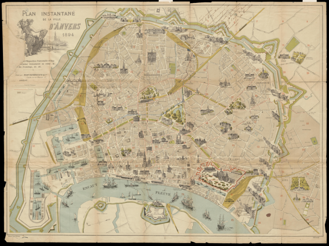
The University of Antwerp has restored a map of Antwerp dating back to 1894. It was printed for the World Fair, which was held in Antwerp between May 5 and November 5 of that year. The fair attracted around 3 million visitors, among them a lot of foreigners who didn’t know their way around town. So the nice people of Antwerp made them a handy map. In red is the World Fair ground. A high-res image of the map can be viewed here. I found my street!
Advertisements Share this: