 HOLT, Fla., Oct. 6, 2017–The National Hurricane Center has adjusted its predictability cone for this afternoon’s update.
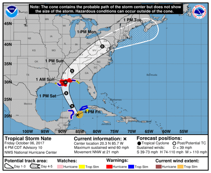
Holt, Crestview, Milton and Pensacola are again outside the cone for now.
A hurricane watch and tropical storm warnings are in effect from the Alabama-Florida border to the Okaloosa-Walton county line. New Orleans to the Alabama-Florida line is under a hurricane warning.
Nate is still moving north-northwest near 21 mph. This motion is expected to continue through Saturday with a turn toward the north and northeast expected Saturday night and Sunday.
Nate will move near or over the northeastern coast of the Yucatan peninsula this evening, into the southern Gulf of Mexico tonight, approach the northern Gulf coast Saturday and make landfall over the northern Gulf coast Saturday night or Sunday.
Winds have increased to near 60 mph. Additional strengthening is forecast during the next 36 hours and Nate is expected to become a hurricane by the time it reaches the northern Gulf of Mexico.
Tropical-storm-force winds now extend outward up to 125 miles mainly to the east of the center.
Along the northern Gulf Coast, hurricane conditions are expected in the hurricane warning area Saturday night, with tropical storm conditions expected by late Saturday.
While not an issue for Holt, a 4-to-6-foot storm surge along the coastal areas is expected.
Share this:
- Share