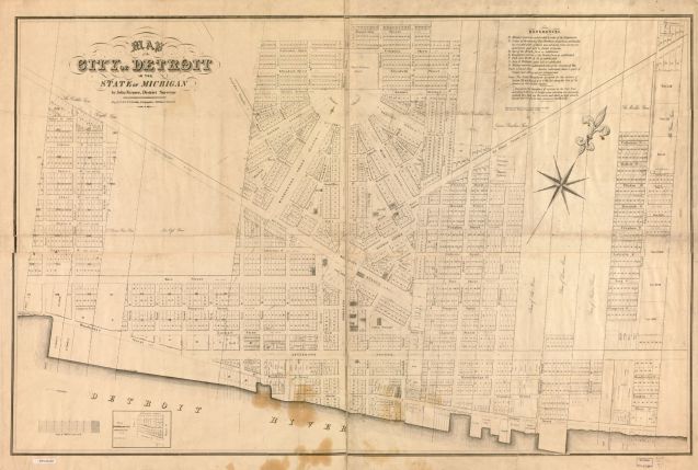
This map of Detroit available in the Library of Congress collections and appears to specifically call out the subdivisions of the Military Reserve (land), Brush Farm, John R. Williams holdings, and those of a Peter Berthlet.
It is unclear what Act of Congress necessitated the creation of this map by the District Surveyor, John Farmer. Amy Elliott Bragg has a nice write-up on The Night Train blog about the Farmer family. Son of John Farmer, Silas Farmer (“Detroit’s earliest map publisher”) was only 4 years old at the time his father created this map.
I found a small triangle of land called “Miami Square” at the northern intersection of Gratiot and Randolph and wondered if it was still called that today. The City recently tested out a pedestrian plaza in that area. It appears to still exist as a park, although completely paved over and no signs or markers except for a large abstract sculpture.
Share this:- More